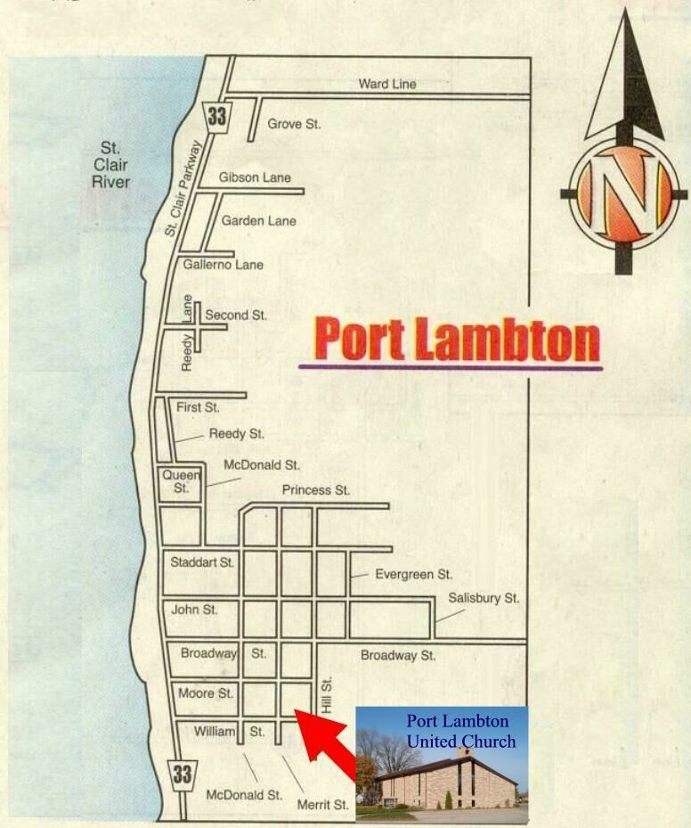
Port Lambton United Church is
located at the corner of William and Merrit Streets, two blocks
east of the St. Clair Parkway, within the Village of Port Lambton, Ontario,
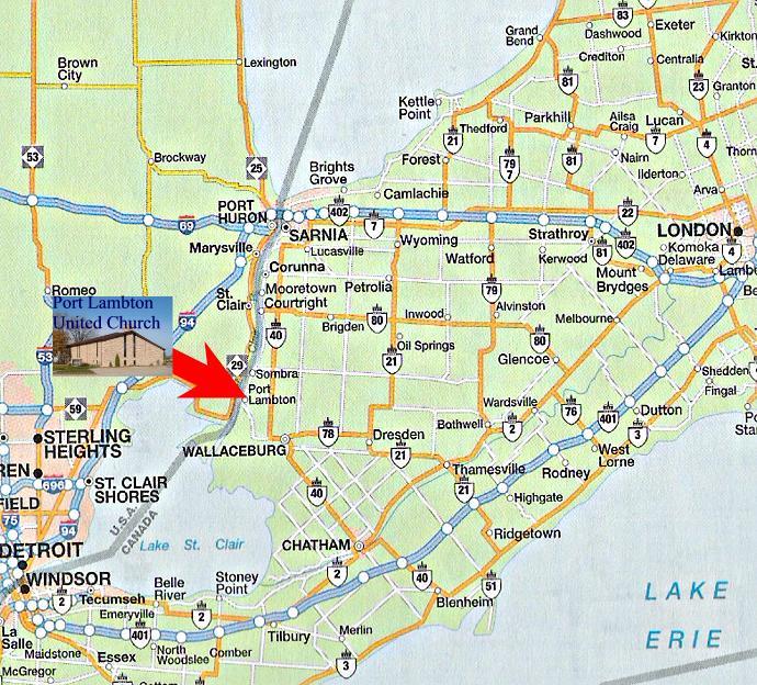
Canada. Port Lambton
is located along the St. Clair Parkway/County Road 33 on the eastern shores of
the St. Clair River
north of Wallaceburg and south of Sarnia.
If you are travelling Highway 40 from Wallaceburg or Sarnia, take the westbound exit
onto Lambton Line/County Road 1. Follow this road into the Village of Port Lambton where the
Lambton Line becomes Broadway Street. Turn left/south onto Hill Street and access the church parking
lot off of this street. If you are travelling County Road 33/St. Clair Parkway, turn east on William Street
with parking available south and east of the church.
If you are travelling from Michigan, ferry service is available at the Algonac/Walpole
Island crossing. After travelling east through Walpole Island, travel north
along the St. Clair Parkway to Port Lambton.